The End of an Era: A Fiery Farewell to Cassini
Winter
2018
Special Feature
The End of an Era: A Fiery Farewell to Cassini
The End of an Era: A Fiery Farewell to Cassini
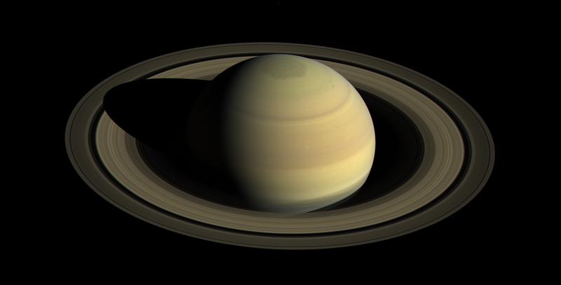
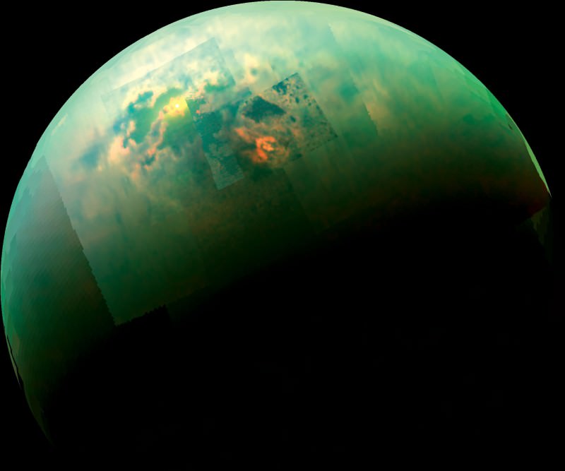
 Since entering orbit around Saturn in 2004, the Cassini probe has provided tens of thousands of images of Saturn, its rings, and its moons—countless glimpses that have elevated our understanding of these bodies in invaluable ways. Cassini was equipped with six remote sensing instruments that imaged in the ultraviolet, visible, infrared, and radio spectra, and six other instruments to analyze the dust, plasma, and magnetic fields around Saturn. Those images have revealed methane lakes and rivers on Saturn’s largest moon, Titan, and cryovolcanoes spewing water from another of its moons, Enceladus. These discoveries have raised the possibility of subsurface oceans on the two satellites, which are of particular interest because they could both harbor life.
In 2017 Cassini began its final chapter. Running out of fuel to maintain its orbit, Cassini’s mission scientists did not want to risk contaminating Titan or Enceladus by impacting them with microorganisms from Earth. Instead, they set Cassini on a collision course with Saturn, to burn up in the atmosphere. After one final close flyby of Titan, Cassini’s orbit was reshaped to dive between Saturn and its rings 22 times before finally plunging into Saturn’s atmosphere on September 15.
Cassini was a collaboration between NASA, the European Space Agency, and the Italian Space Agency. However, many research groups across the world have been, and still are, involved in analyzing the data from Cassini. I work with Dr. Jason Barnes at the University of Idaho, using images from the Visual and Infrared Mapping Spectrometer (VIMS) on Cassini to map the surface of Titan.

Titan’s atmosphere is too dense for us to see the surface in the visible spectrum, but there are five “atmospheric windows” in the infrared spectrum, ranges of wavelengths to which the atmosphere is nearly transparent. We use these five bands to map the surface by combining the data in these wavelengths from hundreds of images to create a single composite. These composites show methane lakes and evaporites, massive dunes of hydrocarbons, and ice mountains. They offer the most complete and detailed glimpses of Titan’s surface that Cassini could provide.

The process to reduce a set of images to a single map is computationally intense. From start to finish, it can take a week to generate a single map. It also requires a significant and specialized computing infrastructure, meaning there are few labs which can create these composites. The goal of my work is to create a publicly available set of maps for each flyby to help preserve the legacy of this voyager and to enable future research about Titan’s surface. //
